The Beautiful Map of Europe Drawn by Its Rivers and Streams

By: Themindcircle
Via Themindcircle

river-maps-europe-1-arttextum-replicacion.jpg

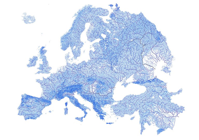
If you have ever wanted to look at a map of Europe and see all of its rivers and streams outlined, well now you can. An Australian Ph.D. student from the University of New South Wales named Robbi Bishop-Taylor is the one who has redrawn Europe by mapping out its waterways.

Bishop-Taylor was able to do this using open source geographic informational software called QGIS to research the 1.35 million streams throughout Europe. The result is a map of European with various blue colors and lines to dictate the different waterways. The thickness of the lines represents the number of each river’s tributaries.
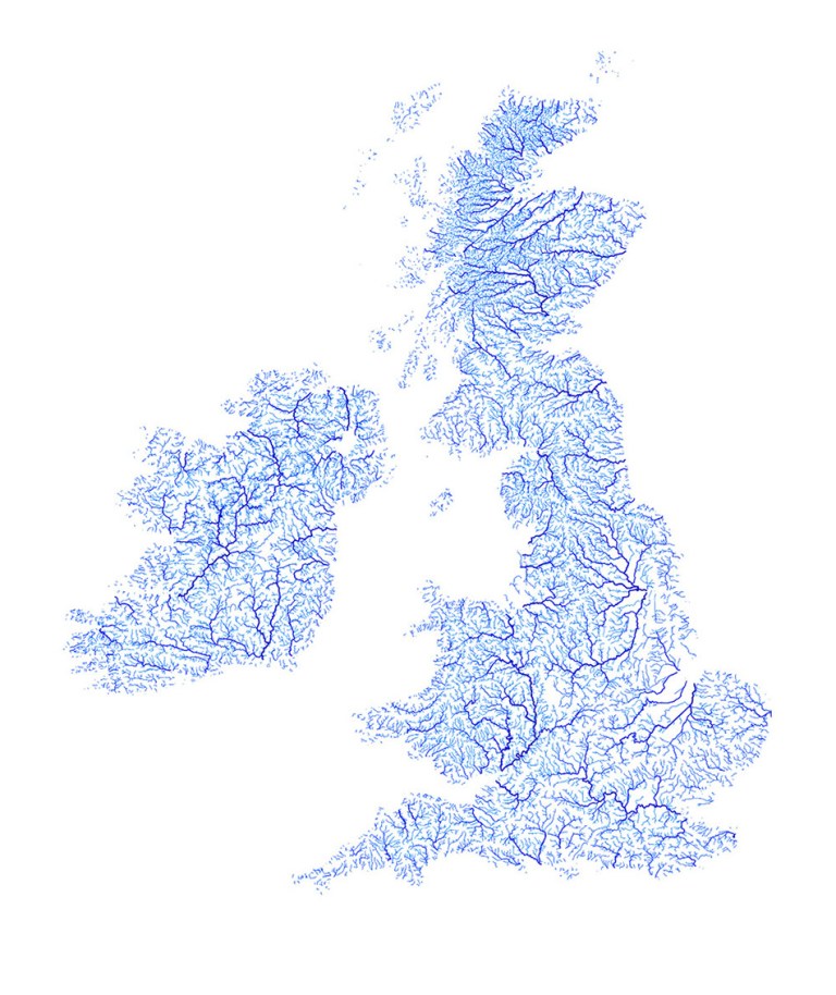
The UK

river-maps-europe-2-arttextum-replicacion.jpg

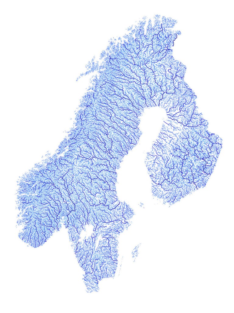
Sweden, Norway and Finland

river-maps-europe-3-arttextum-replicacion.jpg

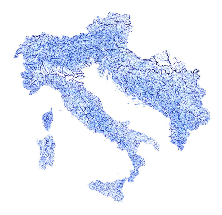
Italy, the Alps and the Adriatic coast

river-maps-europe-4-arttextum-replicacion.jpg

Greece

river-maps-europe-5-arttextum-replicacion.jpg

France

river-maps-europe-6-arttextum-replicacion.jpg

We believe in your work, that's why we share it with original links; if you disagree, please contact us.


Related Arttextum Artists:

Eliana Otta, artista Arttextum
Eliana Otta
Fiamma Montezemolo, artista Arttextum
Fiamma Montezemolo
Barbara Santos, artista Arttextum
Barbara Santos


¿Qué te inspiró más de esta publicación?

Introduce tus datos o haz clic en un icono para iniciar sesión:

Logo de WordPress.com

Estás comentando usando tu cuenta de WordPress.com. Salir /  Cambiar )

Foto de Facebook

Estás comentando usando tu cuenta de Facebook. Salir /  Cambiar )

Conectando a %s

Este sitio usa Akismet para reducir el spam. Aprende cómo se procesan los datos de tus comentarios.